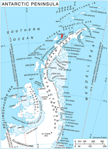
Brabant Island
Second largest island of the Palmer Archipelago within the British Antarctic TerritoryBrabant Island is the second largest island of the Palmer Archipelago within the British Antarctic Territory, lying between Anvers Island and Liège Island. Brabant Island is 59 km (37 mi) long north-south, 30 km (19 mi) wide, and rises to 2,520 m (8,268 ft) in Mount Parry. The interior of the island is occupied by two mountain ranges, Solvay Mountains in its southern part and Stribog Mountains in its central and northern parts.
Read article
Top Questions
AI generatedMore questions
Nearby Places

Djerassi Glacier
Glacier in Palmer Archipelago, Antarctica
Mount Parry
Mountain in Antarctica

Harvey Heights (Antarctica)

Mackenzie Glacier
Glacier in Antarctica

Malpighi Glacier
Glacier in Antarctica

Taran Plateau
Plateau in Antarctica

Mediolana Bluff
Mountain in Antarctica

Venchan Bluff
1,283m bluff in the Palmer Archipelago, Antarctica


